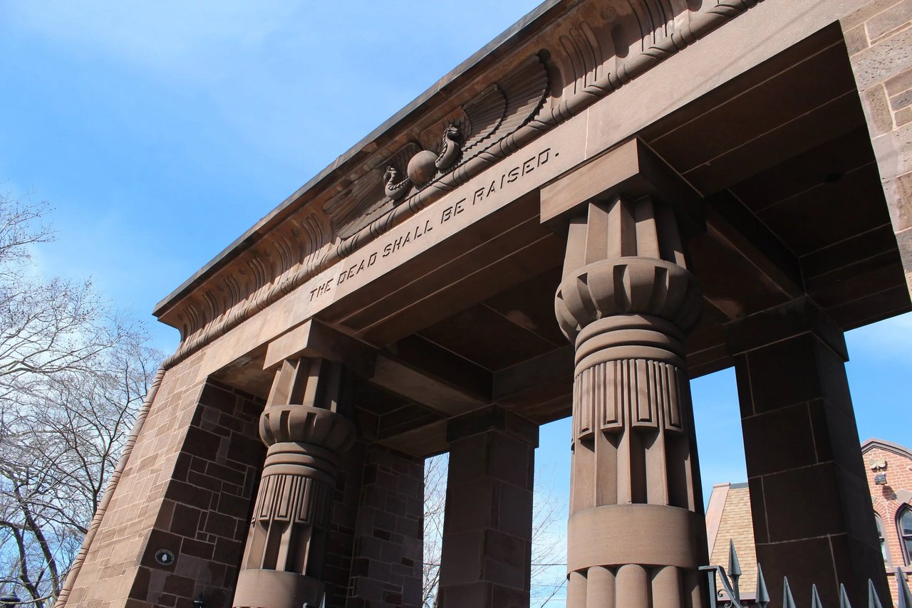
Set aside 30–40 minutes for this visit, starting on the Grove Street sidewalk right outside the main gate. Here, brownstone masonry, a deep rectangular portal, and a continuous iron fence make stepping inside feel like crossing a deliberate threshold. Look up at the lintel to read the inscription, “The Dead Shall Be Raised.” Before searching for well-known names, take a moment to see how the gate functions: it draws a clear line between the everyday city street and the burial ground.
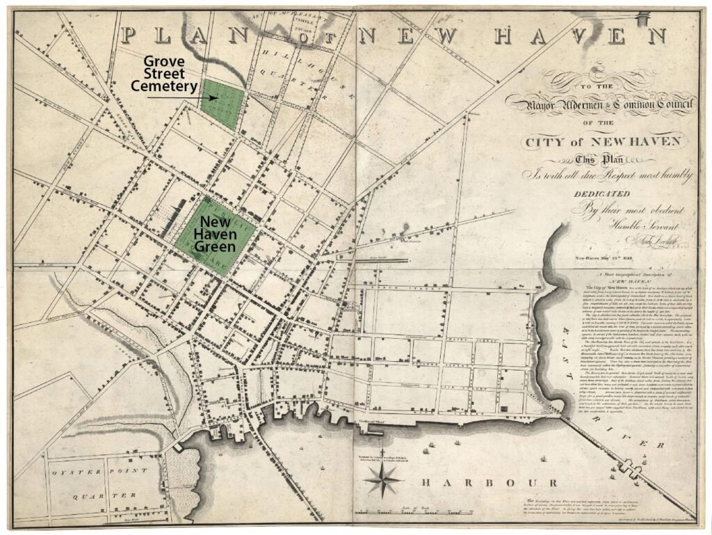
Earlier in New Haven’s history, burials took place on the Green, where graves shared space with worship, trade, and community gatherings in a single civic center. Grove Street marks a shift from that shared pattern. Here, burial moved into a bounded institution defined by an entrance, streets, lots, records, and rules. Official records trace planning to 1796, state incorporation to 1797, and the first burial to November 9 of that same year. The cemetery describes itself as the country’s first chartered burial ground—a distinction worth attributing directly to the cemetery, since claiming to be “first” hinges on how the category is defined.
From the Green to a walled institution
According to the cemetery’s official history, its founding stemmed from overcrowding on the Green and a shift toward non-church management. James Hillhouse joined other local citizens to plan the new site, which was subsequently managed by a board of proprietors after incorporation. Over time, stone walls, iron fencing, and the Egyptian Revival gateway rendered this institutional boundary physical and clear. The site's architectural and landscape evolution, including the gateway associated with architect Henry Austin, is detailed in its National Historic Landmark documentation.
The final burial on the New Haven Green occurred in 1812. Afterward, many headstones were relocated to Grove Street, though many remains stayed in place beneath the Green. This process was far from a straightforward transfer of an intact graveyard. Instead, stones and remains were frequently separated, effectively reorganizing memorial markers within an entirely new setting.
The city grid enters the cemetery
If the gate is open, walk along Central Avenue until you reach the first intersection. Here, named avenues and intersecting cross streets divide the cemetery into rectangular lots. The cemetery’s official introduction describes the site as a “city of the dead.” Here, that phrase functions as a practical description: streets supply addresses, lots define rights and responsibilities, and written records allow burials to be located.
Pause at a single family lot to examine the names and dates carved on the stones. A family lot was a purchased plot intended for multi-generational use rather than a random gathering of graves. Low borders or corner markers may outline its perimeter. While documentation from the New Haven Preservation Trust notes early plot dimensions of roughly 18 by 32 feet, you can appreciate the structure without measuring. The repeated family names, bounded space, and successive dates make the underlying system visible.
While the cemetery's layout noticeably resembles New Haven’s urban grid, this similarity does not mean the cemetery plan was copied directly from the city streets. The more compelling point is shared logic: both the municipal city and the burial ground relied on straight avenues and subdivided plots to make territory organized, legible, and easy to administer.
The back wall: the Green re-indexed
Head toward the rear perimeter to find older slate gravestones associated with the Green. Following their relocation, many of these markers were arranged alphabetically near the rear boundary. As a result, they no longer stand over the original graves of the individuals they commemorate. As noted by the Connecticut Cemetery Association, this arrangement underscores the physical separation between the moved headstones and the remains left behind under the Green.
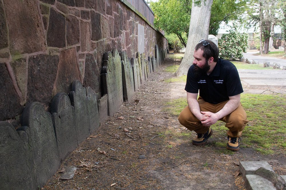
Notice how these older slates differ in material and carving from the monuments lining Central Avenue. While these stylistic contrasts reflect changing dates and funerary traditions, be cautious about interpreting every winged skull or stone variant as a full personal biography. Above all, this row of headstones reflects an administrative decision: memorial markers were removed from one public setting and systematically reindexed in another.
A few nodes in the grid
Notable historical figures buried here include Noah Webster, Eli Whitney, Charles Goodyear, and Roger Sherman. Rather than scanning for prominent monuments, consult the official map or lot registry to locate specific graves. In this spatial layout, even famous figures occupy lots within the same grid and record-keeping system that organizes neighboring families.
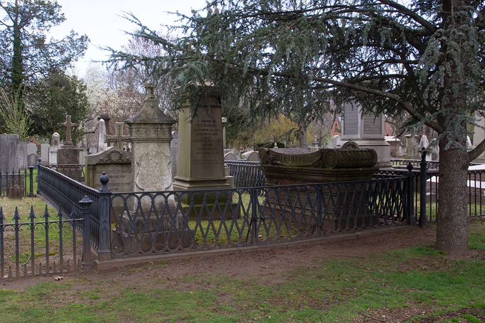
It is best not to assume these monuments share equal size or prominence without comparing them directly on site. What remains clear and supported by the landscape is that the cemetery is not organized around a grand central monument for any single individual. Instead, the grid remains its fundamental organizing structure.
The institution behind the gate
Near the main gate stands an 1872 chapel that was later repurposed into an administrative office, reflecting the ongoing operational work behind the grounds. Managing land records, groundskeeping, visitor access, and active interments requires a functional institution alongside a historic site. Grove Street was named a National Historic Landmark in 2000, but it continues to serve as an active burial ground today.
Be sure to confirm current visiting hours and policies on the cemetery’s rules and FAQ pages before your visit. Posted hours can differ across official pages, though last entry is commonly listed as 3:30 p.m. Always enter through the main gateway. Visitors must refrain from climbing, touching, or crossing walls, fences, trees, or monuments, keeping in mind that these walking paths wind through an active burial ground.
Five questions to take into the field
- Standing at the gateway, what comes into view through the main portal, and what do the stone wall and iron fence keep hidden from the street?
- Looking down from the first intersection, how do street names, straight paths, and marked lot boundaries turn the burial space into something structured and manageable?
- Examining a single family lot, how many generations can you trace using only the markers visible within its borders?
- Looking closely at the rear wall, what physical details show that the older slate markers were reordered in a line rather than left above their original graves?
- When you walk back to the Green, what elements were relocated to Grove Street, what remained under the common, and how did that division alter New Haven's public memory?